|
|
|
|
|
|
|
|
|
|
|
|
|
|
|
|
|
|
 |
 |
|
|
 |
|
|
In coloring a geographical map, it is customary to give different colors to any two countries that have common boundaries. It has been found empirically that any map, no matter how many countries it contains, nor how they are situated, can be so colored by using only four different colors. It is easy to see that three will not suffice.
- Doctor Zukerman

|
Click to stream Part 1 of the Das Cave 1964 Podcast. (30 minutes) Click to stream Part 2 of the Das Cave 1964 Podcast. (29 minutes) Click to download Part 1 of the Das Cave 1964 Podcast. (36 mb) Click to download Part 2 of the Das Cave 1964 Podcast. (35 mb) |
| If the above download links don’t work, try a different browser. Chrome should work. | |
 |
 |
|
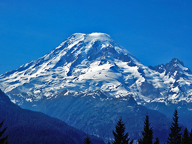
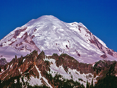
14,410-foot Mount Rainier broods in a domain
far above the Cascades’ lesser peaks. Columbia Crest, the summit, has a cloud licking it. 14,158-foot Point Success is left of Columbia Crest. The Nisqually Icefall is the shadowed ice jumble in the center. 11,138-foot Little Tahoma is the rocky peak on the far right. |
The Emmons Glacier is the smooth slope on the right. The sub summit on the right is 14,112-foot Liberty Cap. |
| All photos by Gerry Roach | |
Copyright © 2001-2023 by Gerry Roach. All Rights Reserved. |