|
|
|
|
|
|
|
|
|
|
|
|
|
|
|
|
|
|
 |
 |
|
|
 |
|
|
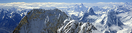
For more information about this wonderful mountain playground, |
Colorado’s Lost Creek Wilderness Summits– Sorted by ElevationNotes |
| Rank LCW |
Elev feet |
Prom feet |
Summit Name | Proximate Parent Line Parent if different |
Iso miles |
Quadrangle | Rg | G | J |
| 1 | 12,431 | 2,451 | Bison Peak | Logan, Mount | 19.18 | McCurdy Mountain | TA | 6 | 20 |
| 2 | 12,429 | 1,759 | “Peak X” B | Logan, Mount | 8.95 | Topaz Mountain | KM | 1 | 16 |
| 3 | 12,340 | 720 | South Twin Cone Peak | “Peak X” B | 5.24 | Mount Logan | PR | 2 | 6 |
| 12,303 | 203 | Blaine A, Mount | South Twin Cone Peak | 1.05 | Mount Logan | PR | 1 | 2 | |
| 4 | 12,274 | 534 | “Peak Y” B | “Peak X” B | 0.96 | Topaz Mountain | KM | 1 | 12 |
| 5 | 12,244 | 304 | “Peak Z” B | “Peak Y” B | 0.69 | Topaz Mountain | KM | 1 | 5 |
| 6 | 12,168 | 789 | McCurdy Mountain | Bison Peak | 2.06 | McCurdy Mountain | TA | 3 | 11 |
| 7 | 12,100 | 320 | “Kenosha Peak” | South Twin Cone Peak | 2.35 | Mount Logan | KM | 1 | 2 |
| S1 | 12,100 | 280 | “X Prime” B | “Peak X” B | 0.85 | Topaz Mountain | KM | 1 | 2 |
| 8 | 12,067 | 337 | “Zephyr” | “Peak Z” B | 0.97 | Topaz Mountain | KM | 1 | 2 |
| 9 | 11,970 | 1,510 | Windy Peak A | Bison Peak | 5.41 | Windy Peak | KM | 1 | 5 |
| 10 | 11,941 | 401 | “Platte Peak” | “Kenosha Peak” | 1.22 | Shawnee | PR | 1 | 2 |
| 11 | 11,927 | 307 | Shawnee Peak | “Platte Peak” | 1.31 | Shawnee | PR | 1 | 7 |
| 11,900 | 40 | “Bison Monolith” | Bison Peak | 0.55 | Farnum Peak | FR | |||
| 11,871 | 211 | Foster Benchmark | South Twin Cone Peak | 1.39 | Mount Logan | PR | 1 | 1 | |
| 12 | 11,789 | 369 | “No Payne” | Shawnee Peak | 1.90 | Shawnee | PR | 1 | 1 |
| 13 | 11,780 | 920 | “Tarryall Peak” | McCurdy Mountain | 2.73 | McCurdy Mountain | TA | 1 | 1 |
| 14 | 11,780 | 520 | Payne Benchmark | “No Payne” | 1.54 | Topaz Mountain | PR | 1 | 4 |
| 15 | 11,762 | 342 | Point 11,762 A | McCurdy Mountain | 1.16 | McCurdy Mountain | TA | 1 | 1 |
| 11,695 | 275 | “Catamount, The” | “Tarryall Peak” | 0.31 | McCurdy Mountain | TA | |||
| 16 | 11,611 | 391 | “Tater Top” TR | Topaz Mountain | 2.54 | Topaz Mountain | TA | 1 | 1 |
| 17 | 11,589 | 929 | Buffalo Peak B | Windy Peak A | 4.26 | Green Mountain | KM | 2 | 3 |
| S2 | 11,517 | 297 | Point 11,517 | Windy Peak A | 1.33 | Windy Peak | KM | ||
| 18 | 11,485 | 345 | Point 11,485 | Bison Peak “Tater Top” |
1.66 1.80 |
Farnum Peak | TA | 1 | 1 |
| 19 | 11,460 | 560 | Point 11,460 A | Point 11,762 | 0.98 | McCurdy Mountain | TA | ||
| 20 | 11,423 | 603 | Point 11,423 A | Point 11,485 | 1.94 | Topaz Mountain | TA | ||
| 21 | 11,403 | 503 | “Lake Park Peak” | “Tarryall Peak” | 1.03 | McCurdy Mountain | TA | 1 | 2 |
| 11,380 | 200 | “Bison View” | Point 11,485 Bison Peak |
1.02 1.35 |
Farnum Peak | TA | 3 | 4 | |
| 22 | 11,328 | 468 | Point 11,328 | Point 11,460 | 0.94 | McCurdy Mountain | TA | ||
| 23 | 11,271 | 484 | Point 11,271 | Windy Peak A | 3.38 | Windy Peak | KM | 1 | |
| 24 | 11,230 | 1,090 | Point 11,230 | Windy Peak A | 2.70 | Windy Peak | KM | ||
| 25 | 11,206 | 1,186 | South Tarryall Peak | Point 11,403 | 1.70 | McCurdy Mountain | TA | 1 | 3 |
| 26 | 11,180 | 400 | “Wigwam Park Peak” | Point 11,230 | 1.35 | Windy Peak | KM | 1 | 1 |
| 27 | 11,180 | 360 | Point 11,180 B | McCurdy Mountain | 1.23 | McCurdy Mountain | TA | ||
| 28 | 10,982 | 482 | Point 10,982 | South Tarryall Peak | 2.52 | McCurdy Mountain | TA | ||
| 29 | 10,926 | 306 | Point 10,926 | Point 11,230 | 0.60 | Windy Peak | KM | ||
| 30 | 10,657 | 767 | “Lost Platte Peak” | Point 11,271 | 3.10 | Windy Peak | PR | 1 | 3 |
| 31 | 10,654 | 634 | Point 10,654 | Point 11,180 A | 2.87 | McCurdy Mountain | KM | ||
| S3 | 10,624 | 284 | Pilot Peak | Point 10,982 | 1.27 | Tarryall | TA | 1 | 1 |
| 32 | 10,620 | 560 | Point 10,620 B | Point 11,180 A | 1.00 | Windy Peak | KM | ||
| 33 | 10,605 | 305 | Point 10,605 | Point 10,654 | 1.22 | McCurdy Mountain | KM | ||
| 9,940 | 120 | X Rock | Point 11,762 | 1.09 | McCurdy Mountain | TA | |||
| 34 | 9,691 | 591 | Castle, The | Buffalo Peak B | 2.57 | Windy Peak | KM | 2 | 1 |
| 35 | 9,500 | 400 | “Wigwam, The” | Buffalo Peak B | 1.49 | Green Mountain | KM | 1 | 1 |
| 36 | 9,300 | 360 | Point 9,300 A | Point 11,328 | 1.41 | McCurdy Mountain | TA | ||
| 37 | 9,242 | 342 | Point 9,242 C | Point 9,300 A | 0.68 | McCurdy Mountain | KM |
Notes by Gerry Roach
|
Copyright © 2001-2023 by Gerry Roach. All Rights Reserved. |