|
|
|
|
|
|
|
|
|
|
|
|
|
|
|
|
|
|
 |
 |
|
|
 |
|
|
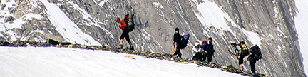
Ye who know the Lone Trail fain would follow it, |
Alaska and Canada’s Summits above 13,000 feet– Sorted by ElevationNotes |
| Rank | Elev feet |
Prom feet |
Summit Name | Proximate Parent Line Parent (if diff) |
Iso miles |
Quadrangle | Rg | St | G | J |
| 1 | 20,320 | 20,172 | Denali - South Peak TR | Yanamax, China Volcan Chimborazo, Ecuador |
4,621.23 |
Mount McKinley A3 | AR | AK | 3 | |
| 2 | 19,540 | 17,215 | Logan, Mount - Main Peak TR | Denali - South Peak AK | 386.3 | McArthur Peak 115 C/9 | SE | YK | 1 | |
| 19,488 | 919 | Logan, Mount - West Peak | Logan, Mount - Main Peak | 1.3 | McArthur Peak 115 C/9 | SE | YK | 1 | ||
| 19,470 | 1,320 | Denali - North Peak TR | Denali - South Peak | 2.0 | Mount McKinley A3 | AR | AK | |||
| 19,357 | 656 | Logan, Mount - East Peak | Logan, Mount - Main Peak | 1.4 | McArthur Peak 115 C/9 | SE | YK | |||
| 18,832 | 262 | Logan, Mount - Houston’s Peak | Logan, Mount - Main Peak | 2.1 | McArthur Peak 115 C/9 | SE | YK | |||
| 18,517 | 1,129 | Logan, Mount - Prospector’s Peak | Logan, Mount - Main Peak | 4.3 | King Peak 115 C/10 | SE | YK | |||
| 18,438 | 1,050 | Logan, Mount - AINA Peak | Logan, Mount - Main Peak | 5.2 | King Peak 115 C/10 | SE | YK | |||
| 18,307 | 262 | Logan, Mount - Russell Peak | Logan, Mount - Main Peak | 3.3 | McArthur Peak 115 C/9 | SE | YK | |||
| 18,176 | 788 | Logan, Mount - North Peak | Logan, Mount - Main Peak | 4.7 | McArthur Peak 115 C/9 | SE | YK | |||
| 18,044 | 656 | Logan, Mount - Northeast Peak | Logan, Mount - Main Peak | 4.2 | McArthur Peak 115 C/9 | SE | YK | |||
| 3 | 18,008 | 11,184 | Saint Elias, Mount - Main Peak TR |
Logan, Mount - Main Peak | 26.0 | Mount Saint Elias B8 USA Newton Glacier 115 C/7 & C/2 Canada |
SE | AK YK |
1 | |
| 17,750 | 500 | Saint Elias, Mount - NW Shoulder |
Saint Elias, Mount - Main Peak |
1.2 | Mount Saint Elias B8 USA Newton Glacier 115 C/7 & C/2 Canada |
SE | YK | |||
| 17,651 | 525 | Logan, Mount - Queen Peak | Logan, Mount - Main Peak | 6.9 | King Peak 115 C/10 | SE | YK | |||
| 4 | 17,400 | 7,250 | Foraker, Mount TR | Denali - South Peak | 14.4 | Talkeetna D3 | AR | AK | 1 | |
| 17,338 | 262 | Logan, Mount - Far East Peak | Logan, Mount - Main Peak | 2.3 | McArthur Peak 115 C/9 | SE | YK | |||
| 17,257 | 787 | Logan, Mount - Northwest Peak | Logan, Mount - Main Peak | 6.9 | King Peak 115 C/10 | SE | YK | |||
| 5 | 17,147 | 9,995 | Lucania, Mount - Main Peak TR | Logan, Mount - Main Peak | 31.6 | Mount Lucania 115 F/1 | SE | YK | 1 | |
| 6 | 16,971 | 3,520 | King Peak TR | Logan, Mount - Main Peak | 8.5 | King Peak 115 C/10 | SE | YK | 1 | |
| 16,812 | 262 | “South Foraker” | Foraker, Mount | 1.0 | Talkeetna D3 | AR | AK | |||
| 7 | 16,644 | 2,394 | Steele, Mount TR | Lucania, Mount - Main Peak | 7.2 | Mount Lucania 115 F/1 | SE | YK | 1 | |
| 16,552 | 802 | Lucania, Mount - Central Peak | Lucania, Mount - Main Peak | 1.5 | Kluane Lake 1:250k | SE | YK | |||
| 8 | 16,550 | 6,900 | Bona, Mount TR | Lucania, Mount, Canada | 49.7 | McCarthy B2 | SE | AK | 1 | |
| 16,550 | 300 | “Southwest Foraker” | Foraker, Mount | 1.3 | Talkeetna D3 | AR | AK | |||
| 9 | 16,390 | 10,540 | Blackburn, Mount TR | Bona, Mount | 60.4 | McCarthy C7 | WR | AK | 1 | |
| 16,286 | 536 | “Kennedy Peak” | Blackburn, Mount | 1.5 | McCarthy C7 | WR | AK | 1 | ||
| 16,263 | < 263 | Lucania, Mount - Northeast Peak | Lucania, Mount - Main Peak | 2.6 | Kluane Lake 1:250k | SE | YK | |||
| 10 | 16,237 | 7,687 | Sanford, Mount TR | Blackburn, Mount | 40.1 | Gulkana A1 | WR | AK | 1 | 1 |
| 16,207 | 262 | Logan, Mount - West Queen Peak | Logan, Mount - Main Peak | 8.3 | King Peak 115 C/10 | SE | YK | |||
| 16,007 | 757 | Lucania, Mount - Southwest Peak aka “Atlantic Peak” |
Lucania, Mount - Main Peak | 2.0 | Kluane Lake 1:250k | SE | YK | |||
| 11 | 15,979 | 9,089 | Vancouver, Mount - Good Neighbor Peak |
Logan, Mount - Main Peak | 28.9 | Mount Saint Elias B5 USA Mount Vancouver 115 B/5 & B/4 Canada |
SE | AK YK |
||
| 12 | 15,885 | 3,635 | Wood, Mount | Steele, Mount | 11.8 | Kluane Lake 1:250k | SE | YK | ||
| 15,741 | < 741 | “Northwest Wood” | Wood, Mount | 1.0 | Kluane Lake 1:250k | SE | YK | |||
| 15,660 | 410 | “West Bona” | Bona, Mount | 1.3 | McCarthy B3 | SE | AK | |||
| 15,638 | 1,188 | Churchill, Mount | Bona, Mount | 2.6 | McCarthy B2 | SE | AK | |||
| 13 | 15,557 | 2,307 | Slaggard, Mount | Wood, Mount | 4.7 | Kluane Lake 1:250k | SE | YK | ||
| 15,387 | 1,637 | Macauley, Mount | Wood, Mount | 1.6 | Kluane Lake 1:250k | SE | YK | |||
| 14 | 15,300 | 13,050 | Fairweather, Mount | Vancouver, Mount - Good Neighbor Peak |
124.4 | Mount Fairweather D5 | SE | AK BC |
1 | |
| 15,250 | 500 | “Southwest Slaggard 1” | Slaggard, Mount | 1.7 | Kluane Lake 1:250k | SE | YK | |||
| 15,050 | 200 | “Northwest Foraker” | Foraker, Mount | 1.7 | Talkeetna D3 | AR | AK | |||
| 15 | 14,950 | 8,700 | Hubbard, Mount | Vancouver, Mount - Good Neighbor Peak |
21.3 | Mount Saint Elias B3 | SE | AK YK |
||
| 14,916 | 166 | “Southeast Churchill” | Bona, Mount | 2.6 | McCarthy B2 | SE | AK | |||
| 16 | 14,831 | 5,181 | Bear, Mount | Bona, Mount | 21.3 | McCarthy B1 | SE | AK | ||
| 17 | 14,787 | 4,537 | Walsh, Mount | Steele, Mount | 11.8 | Kluane Lake 1:250k | SE | YK | ||
| 14,660 | 110 | “North Churchill” | Bona, Mount | 3.9 | McCarthy B2 | SE | AK | |||
| 18 | 14,573 | 4,623 | Hunter, Mount - North Peak TR | Denali - South Peak | 8.6 | Talkeetna D3 | AR | AK | 1 | |
| 14,501 | 751 | “Southeast Macauley” | Slaggard, Mount | 2.7 | Kluane Lake 1:250k | SE | YK | |||
| 14,500 | 1,950 | Alverstone, Mount | Hubbard, Mount | 2.3 | Mount Saint Elias B3 | SE | AK YK |
|||
| 19 | 14,470 | 3,220 | University Peak | Bona, Mount | 4.2 | McCarthy B3 | SE | AK | ||
| 14,450 | 1,500 | Aello Peak | Bona, Mount | 5.4 | McCarthy B3 | SE | AK | |||
| 20 | 14,370 | 3,150 | McArthur Peak | Logan, Mount - Main Peak | 7.0 | McArthur Peak 115 C/9 | SE | YK | ||
| 14,337 | 1,087 | “South Slaggard” | Slaggard, Mount | 2.5 | Kluane Lake 1:250k | SE | YK | |||
| 14,260 | 400 | “Snave, The” | Blackburn, Mount | 3.2 | McCarthy C7 | WR | AK | 2 | ||
| 21 | 14,163 | 5,613 | Wrangell, Mount | Sanford, Mount | 14.8 | Gulkana A1 | WR | AK | ||
| 14,134 | 814 | “East McArthur” | McArthur Peak | 1.1 | McArthur Peak 115 C/9 | SE | YK | |||
| 14,108 | 858 | “Southeast Steele” | Steele, Mount | 3.6 | Kluane Lake 1:250k | SE | YK | |||
| 14,075 | 825 | “Southwest Slaggard 3” | Slaggard, Mount | 3.5 | Kluane Lake 1:250k | SE | YK | |||
| 22 | 14,070 | 5,081 | Augusta, Mount | Saint Elias, Mount | 16.2 | Mount Saint Elias B7 USA Corwin Cliffs 115 C/8 & C/1 Canada |
SE | AK YK |
||
| 14,013 | 563 | “Perch Peak” | Wrangell, Mount | 1.5 | Gulkana A1 | WR | AK | 1 | ||
| 13,966 | 1,116 | Hunter, Mount - South Peak | Hunter, Mount - North Peak | 2.2 | Talkeetna D3 | AR | AK | |||
| 13,950 | 1,000 | “East Aello Peak” | Bona, Mount | 4.5 | McCarthy B3 | SE | AK | |||
| 13,950 | 1,000 | “The Claw” | Bona, Mount | 4.8 | McCarthy B3 | SE | AK | |||
| 13,894 | 1,644 | Kennedy, Mount | Hubbard, Mount | 3.5 | Mount Saint Elias 1:250k US | SE | YK | |||
| 23 | 13,860 | 2,210 | West Atna Peak | Blackburn, Mount | 6.5 | McCarthy C6 | WR | AK | ||
| 24 | 13,845 | 4,395 | Regal Mtn | West Atna Peak | 12.2 | McCarthy C5 | WR | AK | ||
| 13,845 | 525 | “East King” | King Peak | 1.9 | King Peak 115 C/10 | SE | YK | |||
| 25 | 13,832 | 11,507 | Hayes, Mount | Sanford, Mount | 126.8 | Mount Hayes C6 | AR | AK | ||
| 13,820 | 70 | “South Fairweather” | Fairweather, Mount | 1.0 | Mount Fairweather D5 | SE | AK | |||
| 26 | 13,818 | 2,568 | Avalanche Peak | Slaggard, Mount | 7.5 | Kluane Lake 1:250k | SE | YK | ||
| 13,811 | 1,410 | Newton, Mount | Saint Elias, Mount | 3.2 | Newton Glacier 115 C/7 & C/2 |
SE | YK | |||
| 27 | 13,760 | 7,710 | Cook, Mount | Vancouver, Mount - Good Neighbor Peak |
14.5 | Mount Saint Elias A6 | SE | AK YK |
||
| 13,750 | 1,500 | “Chitna Peak” | Slaggard, Mount | 4.2 | Kluane Lake 1:250k | SE | YK | |||
| 13,750 | 500 | “Southwest Slaggard 2” | Slaggard, Mount | 2.8 | Kluane Lake 1:250k | SE | YK | |||
| 13,750 | 500 | “Southwest Slaggard 4” | Slaggard, Mount | 4.3 | Kluane Lake 1:250k | SE | YK | |||
| 28 | 13,750 | 2,000 | Strickland, Mount | Avalanche Peak | 3.0 | Kluane Lake 1:250k | SE | YK | ||
| 13,650 | 400 | East Atna Peak | West Atna Peak | 0.6 | McCarthy C6 | WR | AK | |||
| 13,605 | 455 | “West Fairweather” | Fairweather, Mount | 1.3 | Mount Fairweather D5 | SE | AK BC |
|||
| 13,560 | 1,310 | Quincy Adams, Mount | Fairweather, Mount | 2.7 | Mount Fairweather D5 | SE | AK BC |
|||
| 13,550 | 1,500 | Ocypete Peak | Bona, Mount | 7.1 | McCarthy B3 | SE | AK | |||
| 13,535 | 185 | “South Quincy Adams” | Quincy Adams, Mount | 0.4 | Mount Fairweather D5 | SE | AK | |||
| 13,450 | 600 | Hunter, Mount - Middle Peak | Hunter, Mount - North Peak | 1.5 | Talkeetna D3 | AR | AK | |||
| 13,441 | 1,302 | “Catenary Peak” | McArthur Peak | 2.9 | McArthur Peak 115 C/9 | SE | YK | |||
| 13,440 | 1,490 | East Kahiltna Peak TR | Denali - South Peak | 3.7 | Talkeetna D3 | AR | AK | 1 | ||
| 29 | 13,421 | 4,771 | Jarvis, Mount | Wrangell, Mount | 13.0 | Nabesna A6 | WR | AK | ||
| 13,350 | 1,300 | Celeno Peak | Bona, Mount | 8.0 | McCarthy B3 | SE | AK | |||
| 13,350 | 600 | “The Fin” | Foraker, Mount | 4.1 | Talkeetna D4 | AR | AK | |||
| 30 | 13,345 | 5,895 | Natazhat, Mount | Bear, Mount | 16.5 | McCarthy C1 | SE | AK | ||
| 13,315 | 1,665 | “East Bona” | Bona, Mount | 3.3 | McCarthy B2 | SE | AK | |||
| 13,305 | 800 | “South Hayes” | Hayes, Mount | 1.1 | Mount Hayes C6 | AR | AK | |||
| 13,280 | 930 | “Parka Peak” | West Atna Peak | 2.2 | McCarthy C6 | WR | AK | |||
| 31 | 13,250 | 2,000 | Craig, Mount | Avalanche Peak | 4.5 | Kluane Lake 1:250k | SE | YK | ||
| 13,250 | 1,000 | Snowfield Peak | Avalanche Peak | 2.0 | Kluane Lake 1:250k | SE | YK | |||
| 32 | 13,220 | 3,270 | Silverthrone, Mount | Denali - South Peak | 10.8 | Mount McKinley A2 | AR | AK | ||
| 13,182 | 256 | Logan, Mount - Southeast Peak | Logan, Mount - Main Peak | 2.9 | McArthur Peak 115 C/9 | SE | YK | |||
| 33 | 13,177 | > 2,000 | Waddington, Mount | Rainier, Mount WA | 349.1 | Mount Waddington 92 N6 | BCC | BC | ||
| 34 | 13,176 | 10,751 | Marcus Baker, Mount | Wrangell, Mount | 128.3 | Anchorage B2/B3 | CG | AK | ||
| 13,025 | 775 | “North Jarvis” | Jarvis, Mount | 3.1 | Nabesna A6 | WR | AK | |||
| 35 | 13,020 | 3,970 | Moffit, Mount | Hayes, Mount | 10.4 | Mount Hayes C5 | AR | AK | ||
| 13,009 | 959 | Zannett, Mount | Wrangell, Mount | 3.8 | Gulkana A1 | WR | AK |
Copyright © 2001-2023 by Gerry Roach. All Rights Reserved. |