Never try to teach a Highpointer to sit still.
It’s a waste of your time and it annoys the Highpointer.
– Jack Longacre |
10,033 miles,
22 state highpoints,
7 national park highpoints
A sojourn by Gerry Roach |
| Having done all the western state summits, I always assumed that I would finish the state summit list.
Busy with Himalayan and Alaskan giants, I always told myself, “someday,” or,
“I can do that when I’m old.” Finally, in the spring of 2006, it dawned on me that
several somedays had already passed, and that while not old, I was definitely getting older.
Fussing over the fact that I’m not retired but just can’t get a job anymore,
I pondered deeper that while I had no money, I did have the other vital element for a trip: time.
Finally, I reasoned that gas would never be cheaper. Thus it was that I put my kit in the car and drove east on May 6, 2006.
I had the basic plan that I would go from south to north, the requisite guidebooks, and a few maps,
but knew that I would have to figure out the details as I went along. My sojourn would be largely freeform
a rare treat in this hurly-burly world. |
| In addition to the 22 state highpoints I needed to finish, I planned to visit 7 national park highpoints as well,
so for my overture, two days later I stomped several miles through sometimes-thick brush to ensure that I had reached
the highpoint of Mammoth Cave National Park. I rationalized that, “if I’m going highpointing, I better get it right!”
I think I overdid it on this one. If you pull over in the perfect place, you can achieve this highpoint in 60 seconds
from your vehicle. After overrunning this highpoint, I hustled off for a cave tour. Then it was off to the six-pack. |
| For astute highpointers, the six-pack has nothing to do with beer, just the highpoints of KY, VA, TN, NC, SC, and GA.
I knew that speed seekers had tagged these highpoints in a loooong day, but I was not after records,
just a rational rendering that allowed plenty of time for photography. Accordingly, I planned two summits per day,
plus another day to visit Congaree National Park in SC. |
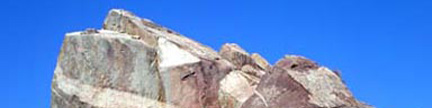
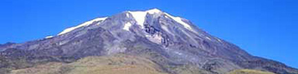
| After a longer drive than I planned for, I found myself on top of KY’s Black Mtn at mid-day on May 9th.
After kicking around among the cans and construction debris, I filed this highpoint as a candidate for America’s
least loved state highpoint. My second goal for this day was to be a hike up Mt Rogers in VA. However after a
careful study of the map and the hike, I realized that I didn’t have sufficient time for a sane soiree.
“Jeesh,” I thought, “It’s only my second day, and I’m already behind!” Another look at the map convinced me
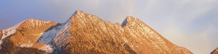
that I did have time to drive up mighty Mt Mitchell. En route, grinding up a long, curvy hill at 10 mph behind
a groaning truck, I questioned this plan as well. I calmed myself down with the thought,
“Hey, I don’t have a schedule, so I can’t be behind!” Then the clouds settled in. |
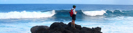
| Purring forward and upward, I broke above the clouds in time for a late afternoon photo fest in long light.
Excited to be on the highest point east of the Mississippi, I didn’t dwell on the thought that this would
be the high point of my trip, and that it was all downhill from here. On top of Mitchell,
I met a couple of highpointers who had just come from Clingmans Dome and they told me that they couldn’t
make the tippy top because it was closed for construction. Since this was my intended goal for the next morning,
I pressed them for details and they assured me that serious barricades were up and that the workers
were actively chasing down any dodgers and shooing them away. Returning to my maps, I made my second
free form change of the day and headed toward SC instead. I would pick up Clingmans later when, I assumed,
the construction would be finished. Maybe I was behind, but I was learning quickly. Applying a western eye
to the apparently short distances here doesn’t translate to a good plan. |
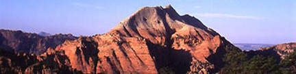
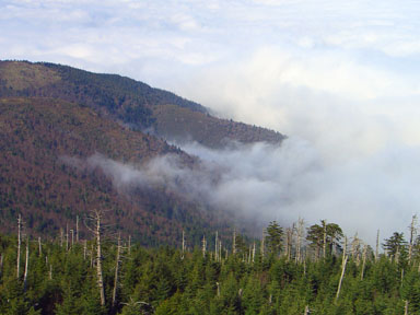
| The next morning on top of Sassafras was delightful. The cloud-shrouded summit seemed to be the only
summit in the world, and the only summit the world needed. I spent ample time photographing roots and moss rocks.
Later that day, I repeated the experience on GA’s Brasstown Bald. I had both sanguine summits to myself,
and striding about in the swirling mists, I wondered what the weather would be like farther north. |
| With the weather getting worse not better, I spent the next day visiting SC’s Congaree National Park.
This park’s highpoint is just an excuse to visit the park, since you are basically at the highpoint
when you pass the park entrance sign. Purists will want to wander a hundred yards from this sign
to the park boundary, which is sharply delineated by clear-cut logging. Never have I seen such an
obvious demarcation between destroyed and preserved land. The boardwalk through the bottomland gave me
a chance to further appreciate the preservation. Next, it was back to my six-pack work. |
| Now, I had to pay the penalty for deferring both VA’s Mt Rogers and TN’s Clingmans Dome.
I was out of position, and Rogers and Clingmans do not make a good pairing. My next lesson was upon me:
free-forming plus adding the national parks greatly complicates the flow. Nevertheless, I made a plan.
Early the next morning I suited up at the trailhead for Rogers, pulling on warmies that I didn’t think
I would be using until New England. Setting my mountaineering jaw and taking my first strides on the
Appalachian Trail, I strode forth into the cold and wind, passing many soggy backpackers who were
eager to be lower. |
| Have you ever been listening to music in the background, but completely absorbed in another task?
Then suddenly dismissing your chosen task, the music commands your attention, shoulders your soul
and sweeps you away until you have no memory of what it was that you were so engrossed in before.
Even when you manage to remember, you cannot fathom why it was important. Sometimes the real world
is just an inch away. Rogers was like this for me. For a few hours there was nothing but striding,
the wind, clouds and cold. |
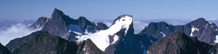
| Later that evening, I repeated the experience on Clingmans. After hours on a Friday, the workmen were
all gone, allowing me to climb easily around the barriers and stride up the newly paved trail to the
tower as the winds scoured the air and ripped the clouds apart. Again, I had a famous place all to myself,
and reveled in what had to be the clearest views in awhile. Statistics and accolades faded as I photographed.
It was simply enough to be there. Then, with the six-pack in my pocket, I moved north. |
| On May 13th, I visited Shenandoah National Park, VA where road signs for Washington DC surprised me.
Yes, the land-locked westerner had finally arrived in the east. Reports of flooding in New England concerned me,
but I wasn’t there yet. Setting my highpointer jaw, I resolved to tag the “three-pack”
in one day: WV, MD, and PA. Getting better at the game, I dodged washouts and construction to
top WV’s Spruce Knob early on May 14th, then scurried up MD’s Backbone Mtn under clouds
that looked like they could flush at any moment. Heading north into PA the music changed, and they did empty.
Pulling into a service station, I knew that I was poised for a lifetime personal best: This was the
only day of my life when I could summit three new state summits in one day, but my unstoppable watch
kept moving toward dusk. Grabbing more warmies and rain gear from my well-stowed kit, I changed in the
station rest room, emerged like a Navy Seal, and headed for PA’s Mt Davis. Not surprisingly,
mine was the only car in the rain-pounded parking lot. Hood up, I emerged to explore another state summit
by myself for half an hour. In spite of my best efforts, I got soaked. |
| Knowing that there was no way I could summit the great New England peaks in these conditions,
I stayed low. On May 15th, I parked near DE’s Ebright Azimuth, and Doreen ran out of the house
with her register book practically shouting the great line, “You look like a Highpointer!”
We posed for photos and chatted for quite awhile. For Doreen, the street corner might as well be Mt Everest.
Sometimes it’s just an inch away, and I nominate Ebright Azimuth for one of America’s most loved state highpoints.
Later that day I explored Washington DC’s Fort Reno my extra credit. |
| In the next two days, my now well-lubricated highpointing machine took me to High Point NJ and Jerimoth Hill RI
where I enjoyed the labors of many club members as I walked on the new trail to the summit rock.
I thought it appropriate that the rock is unadorned. Descending to the coast, I stayed with Dave Covill’s parents,
Ruth and Ray a visit I enjoyed very much. Then, with 12 states and 4 parks notched on my soggy belt,
it was off to New Haven CT for my “Halftime.” |
| By prearrangement, I met my sister Charlotte there for a week of festivities around her middle son, my nephew,
Torger who was getting his PhD at Yale. Torger is the first family member to get a PhD since my dad in
the early 1930s, and this was a big family event. Switching gears, I explored Yale’s hallowed halls,
learned much, learned that there is much to learn, discussed music, art, language, philosophy, religion,
politics, and sex. I even got to roll my own impression of a conical tablet from the western Hemisphere’s
largest tablet collection. Still not satisfied, we visited the Museum of Natural History in New York.
I also learned that commencement at Yale is a big deal. Only when Torger’s degree was safely tucked
in his belt did I continue my Sojourn. My halftime gave the flood waters a chance to recede. |
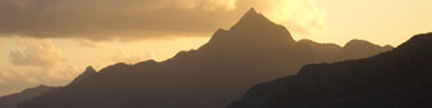
| Picking up where I left off, I tagged CT’s liner on Mt Frissell and MA’s Greylock on May 23rd.
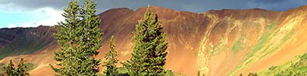
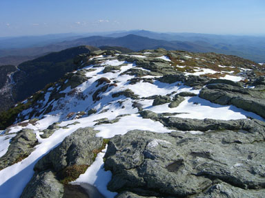
Now for New England’s big boys. In improving weather, I arrived at the base of VT’s Mt Mansfield
late on May 24th to learn that the road was still closed. Undeterred, I hiked up the Long Trail
to reach the top late in the day. Again, I had a popular highpoint to myself in the evening,
as the long light glanced off the lingering snow slopes. |
| With a bit of a driving backtrack, I hiked up NY’s Mt Marcy the next day. Now blessed with the
best weather of the trip, I was able to lounge on the summit like the intrepid traveler that I had become.
I arrived at the base of NH’s Mt Washington along with the Memorial Day weekend crowds.
The road was still closed, and it was not clear which inch was in control. Ignoring the road,
I hiked up a variation of the Tuckerman’s Ravine Trail on May 27th. The clouds controlled the summit that day.
When I entered Maine the next day, I announced to the desk clerk at the border visitor center,
“I have now visited all 50 states!” She replied instantly, “You saved the best for last!” |
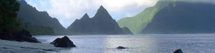
| With the sun shining, I visited Acadia National Park with a thousand of my best friends.
Prophetically, the rocky, crowded, tourist summit is not the park highpoint. That is 200 yards behind
the summit store, and I had that quiet rock to myself. Finally poised for Katahdin, the sun continued
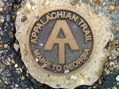
to shine. Since I had driven from GA, I decided to hike up the end of the Appalachian Trail,
and captured a portrait of the last trail marker. With the sun shining on my now weary bones,
I felt done, but still had much to do. My halftime should have been called third time. |
| Hungry for new views, I drove north into Canada’s Maritimes, visited Maine’s northernmost point
and the St Lawrence Seaway before driving into the worst rain of the trip. I resolved never to live
downwind of the Great Lakes. After surviving stupefying traffic jams in Toronto and Chicago,
I arrived at IL’s Charles Mound on it’s open access day, June 3rd. By prearrangement, I met
John Mitchler and his wife Kathy Delsasso here for the trek to the top. There were many highpointers
taking advantage of this open access date, and we had a bit of a party. |
| Alone again and smelling the finish line, I drove north and found my way to MI’s Mt Arvon on June 4th,
MN’s Voyageurs National Park on June 5th, MN’s Eagle Mtn on June 6th, and MI’s Isle Royale National Park
on June 7th. Whew! Dave Covill had advised me that no one had ever finished the 50 in WI, so I retreated
there for my big finish. Also, I have some family history in WI, since that is where my parents met and
romanced. Perhaps previewing my athleticism, my mom was the first person to swim the length of Lake Geneva, WI.
Thus it was that I walked up to the tower on Timms Hill on June 9th, looked around carefully to see if anyone
was watching, stuck my foot an inch from the highpoint, pondered that inch, then stomped it down on the highpoint.
Appropriately for my solo sojourn, nobody was watching. In fact, there was nobody else in the area.
My deed went unnoticed. |
| One of the conversations I had at Yale was with a music student. When I expressed delight with the
symphonic transcription of Bach’s famous organ piece, his Toccata and Fugue in D Minor, she replied,
“If Bach had wanted to write it for full orchestra, he could have.” Perhaps, and perhaps even probably.
However, he didn’t, and that creation fell to other fingers. The transcription exists and the
Los Angeles Philharmonic has presented Esa-Pekka Salonen’s interpretation with astonishing clarity.
It stands as an offering to the world, and you are free to relish or ignore it. Every time a conductor
raises a baton, a singer draws breath from the diaphragm, or a bow quivers poised over strings,
a new interpretation is about to be born. Indeed, new music leaps from brain-powered fingers every day.
And so it is with Highpointing. Every time a car is started, a boot is laced, or an eye raises to the heights,
a new adventure is born. My sojourn is a small example that can never be repeated exactly, but I hope that it
will inspire your new music. Perhaps your climb will be the music that jerks many away from the mundane. |
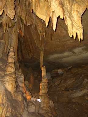 |
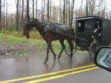
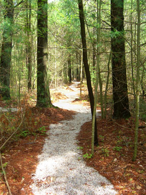
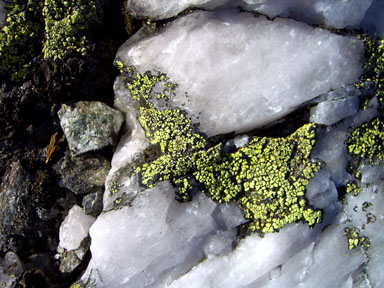
Mammoth Cave National Park, KY |
 |
Black Mountain, KY |
 |
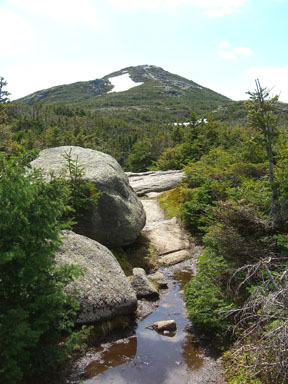
Mount Mitchell, NC |
 |
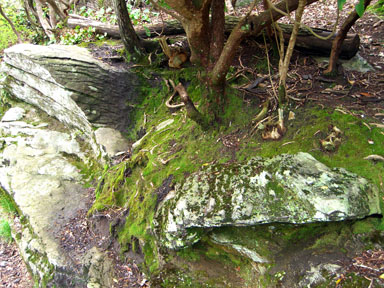
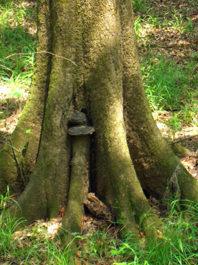
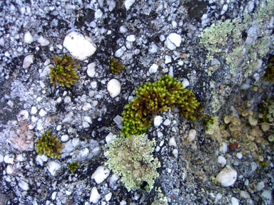
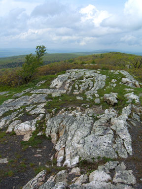
Sassafras Mountain, SC |
 |
Sassafras Mountain, SC |
 |
Brasstown Bald, GA |
 |
Brasstown Bald, GA |
 |
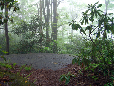
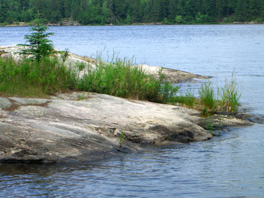
Congaree National Park, SC |
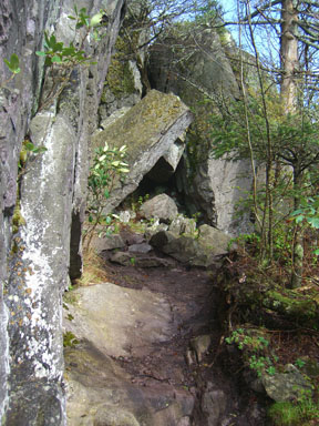 |
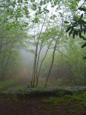
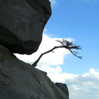
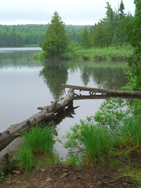
Mount Rogers, VA |
 |
Mount Rogers, VA |
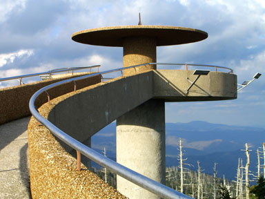 |
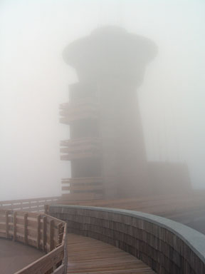
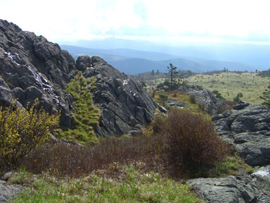
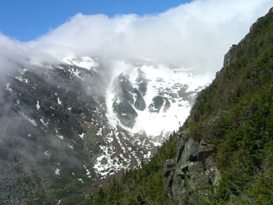
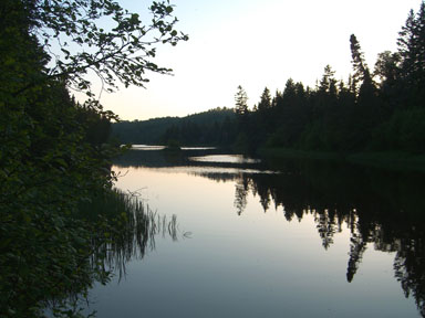
Clingmans Dome, TN
Great Smoky Mountains National Park, TN/NC |
 |
Clingmans Dome, TN
Great Smoky Mountains National Park, TN/NC |
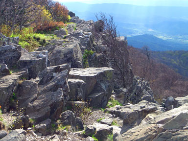 |
Shenandoah National Park, VA |
 |
Spruce Knob, WV |
 |
Backbone Mountain, MD |
 |
Mount Davis, PA |
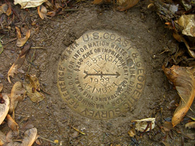 |
Ebright Azimuth, DE |
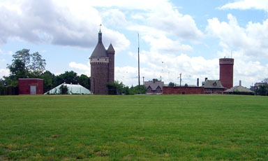 |
Fort Reno, Washington DC |
 |
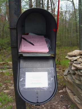
High Point, NJ |
 |
Jerimoth Hill, NJ |
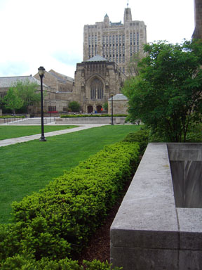 |
Yale, New Haven, CT
Where’s the library at? |
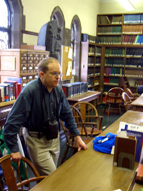 |
Yale, New Haven, CT
Dr Torger Vedeler at work |
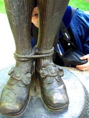 |
Yale, New Haven, CT
Dr Torger Vedeler goofing off |
 |
New York, NY |
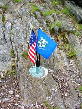 |
Mount Frissell, CT |
 |
Mount Greylock, MA |
 |
Mount Mansfield, VT |
 |
Mount Mansfield, VT |
 |
Mount Marcy, NY |
 |
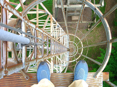
Mount Washington, NH |
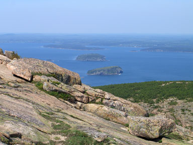 |
Acadia National Park, ME |
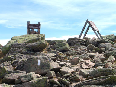 |
Mount Katahdin, ME |
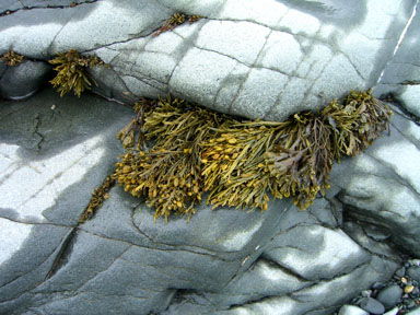 |
Quoddy Head, ME |
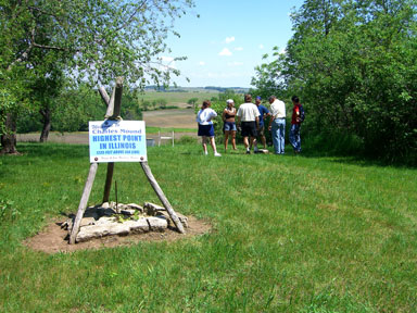 |
Charles Mound, IL |
 |
Mount Arvon, MI |
 |
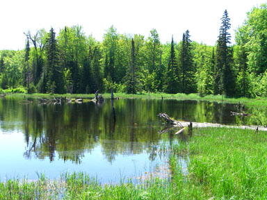
Voyageurs National Park, MN |
 |
Eagle Mountain, MN |
 |
Eagle Mountain, MN |
 |
Isle Royale National Park, MI |
 |
Timms Hill, WI |
| All photos are by Gerry Roach |