|
|
|
|
|
|
|
|
|
|
|
|
|
|
|
|
|
|
 |
 |
|
|
 |
|
|
My fun meter was pegged! |
|
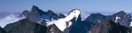
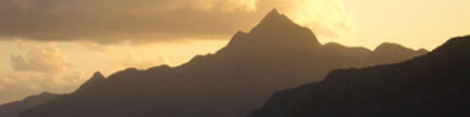
Climbing Mount Griggs, August 11, 2004 |
|
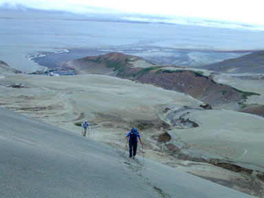 |
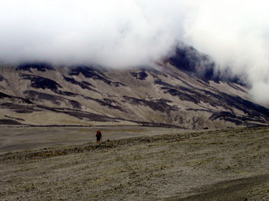
Under a cloud-shrouded sky, we begin our 6,000-foot ascent up Mount Griggs Brad Alber follows dad Chad up one of the initial slopes You can see our campsite above the photo’s left center |
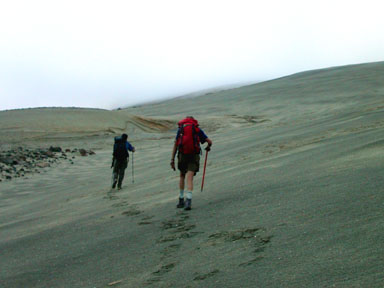 |
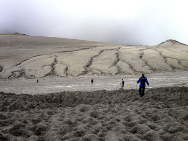
Jobe Wymore and Rick Trujillo head up the huge hill toward the summit-consuming cloud The tuff was easy to walk on and held a step like snow In spite of our tracks, Rick carries a GPS in his left hand to protect our retreat in this homogenous, undulating landscape |
 |
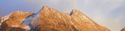
Rick Trujillo striding toward the still-huge upper mountain Griggs is an old volcano that predates the 1912 eruption, and the lighter colored tuff from the recent eruption coats Griggs’ lower slopes while the black rock higher up is Griggs’ original rock |
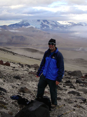 |
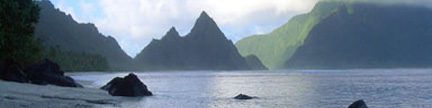
Chad Alber taking a break in the transition zone between the recent smothering tuff and Griggs’ mother rock Chad’s goggles, besides looking cool, provide eye protection against the blowing tuff, which can clobber your contacts in a second Mount Mageik floats across the valley under a distant but encouraging patch of blue |
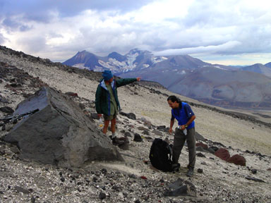 |
Rick Trujillo, one of the best exploration geologists in the US, explains one of the many fine points about the extraordinary area that we have placed ourselves in |
 |
Under an improbable but pervasive patch of blue overhead, we headed toward the 6,150-foot saddle west of the summit massif |
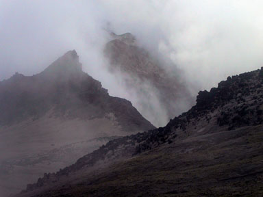 |
What happened to the weather? No more blue sky in sight Above the saddle, the upper mountain took on a more serious countenance |
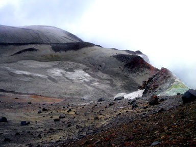 |
Griggs has two craters which are concentric on the large summit area’s west side Pulling over the edge, we found the smaller inner crater You can see an active fumarole near the yellow sulphur on the photo’s right edge |
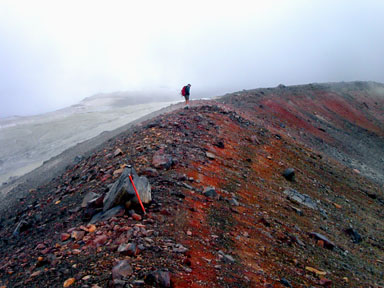 |
Rick Trujillo examines the smaller crater from its rim We knew that the mountain’s highpoint was farther east on the rim of the older, outer crater and we could just see its outline in the still swirling clouds |
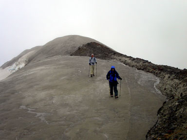 |
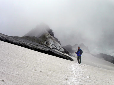
To our surprise the outer crater rim was covered with ice and guarded by a pesky bergschrund After crossing the schrund near its north end, we were further surprised that the summit was not where the map’s highest contour indicated that it would be Here, Brad and Chad Alber stride south over ice along the outer crater’s rim toward what we still assumed would be an easy summit |
 |
We reached what we thought was the summit, but just before handshakes and backslaps,
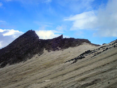
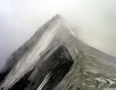
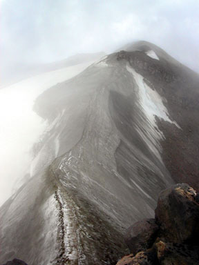
Knife Peak, which was clearly higher, appeared out of the clouds to the south This view of the icy knife edge leading to the summit rocks was disheartening, since we had chosen to come here without crampons or ice axes |
 |
With our trusty ski poles poised for action, we retreated back the way we had come to an easy-angled snow slope below the bergschrund, and traversed south below Knife Peak looking for a rock route |
 |
The bergschrund below Knife Peak presented a non-trivial obstacle, which we now had to re-cross |
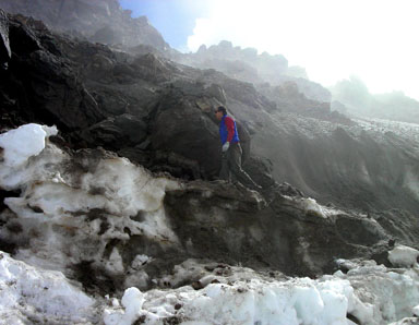 |
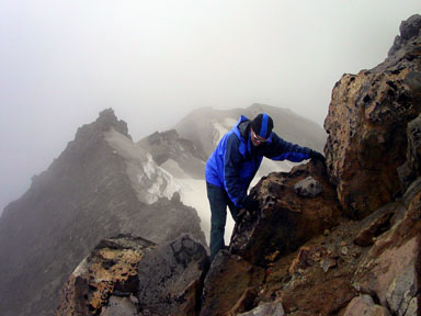
After crossing the schrund, Jobe Wymore heads up to take a look We climbed the grungy 100-foot pitch above Jobe to reach a notch in the ridge south of the summit |
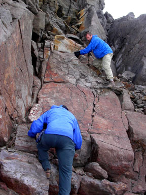 |
Chad Alber, with son Brad above, negotiate the crux, Class 3 pitch on Knife Peak’s southern summit rocks |
 |
Master Chad Alber steps carefully around the exposed corner at the top of the Class 3 pitch |
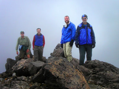 |
Success! Rick Trujillo, Jobe Wymore, Brad Alber and Chad Alber celebrate on the summit of Mount Griggs |
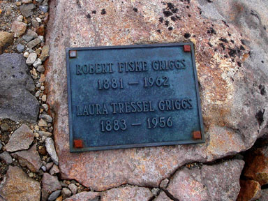 |
One of two memorial plaques on the summit of Mount Griggs |
 |
Looking north from the summit down the icy ridge and across the false summit where we first spotted Knife Peak |
 |
Descending the sometimes ash-covered ice between the two craters |
| Gerry took the above photos on August 11, 2004 | |
| Continue to the Valley | |
| Continue to the Flight | |
Copyright © 2001-2023 by Gerry Roach. All Rights Reserved. |