|
|
|
|
|
|
|
|
|
|
|
|
|
|
|
|
|
|
 |
 |
|
|
 |
|
|
A man should live to realize himself. If not, life makes no sense. |
|
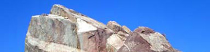
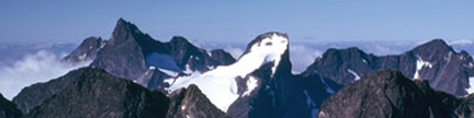
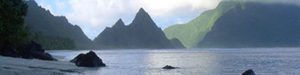
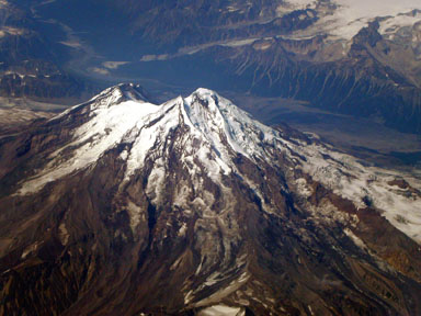
Approaching Katmai’s Mount Griggs, August 2004 |
|
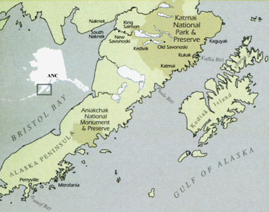 |
Welcome to Alaska aka the Great Land Katmai National Park is on the Alaska Peninsula, which leads toward the Aleutian Islands The center of the large 4.7 million acre park is 160 miles southwest of Anchorage |
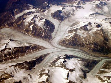 |
Welcome to the Great Land Our one hour flight from Anchorage to King Salmon provided many examples of where the nickname “Great Land” comes from |
 |
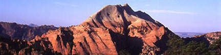
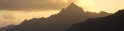
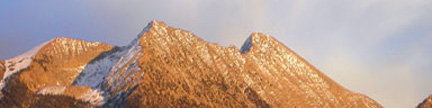
Even before we reached King Salmon, we were enticed by another peak –
10,197-foot Redoubt Volcano, which is the highest peak in Lake Clark National Park This photo shows the northeast flank of the mountain |
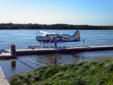 |
In King Salmon, we transferred to Katmai Air’s float plane for the flight to Brooks Camp in Katmai National Park |
Katmai is famous for volcanoes, brown bears, fish and rugged wilderness, and is also the site of the Brooks River National Historic Landmark with North America’s highest concentration of prehistoric human dwellings (about 900). |
|
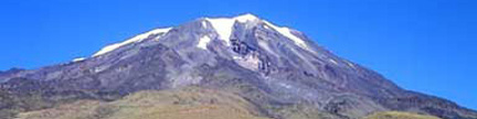
| Katmai National Monument was created in 1918 to preserve the famed Valley of Ten Thousand Smokes, a spectacular forty square mile, 100 to 700 foot deep, pyroclastic ash flow deposited by Novarupta Volcano during the great eruption of 1912. The monument was upgraded from a monument to a national park in 1980. Today, there are at least fourteen volcanoes in Katmai National Park considered “active,” none of which are currently erupting. An old volcano, Mount Griggs at 7,650 feet is the highest peak in the park, and was the major objective of our expedition. | |
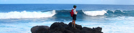
| Brown bear and salmon are very active in Katmai. The number of brown bears has grown to more than 2,000. During the peak of the world’s largest sockeye salmon run each July, and during return of the “spawned out” salmon in September, forty to sixty bears congregate in Brooks Camp along the Brooks River and the Naknek Lake and Brooks Lake shorelines. Brown bears along the 480 mile Katmai Coast also enjoy clams, crabs, and an occasional whale carcass. A rich variety of other wildlife is found in the Park as well. | |
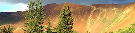
| There is plenty room for great diversity of wildlife in Katmai which encompasses millions of acres of pristine wilderness, with wild rivers and streams, rugged coastlines, broad green glacial hewn valleys, active glaciers and volcanoes, and Naknek Lake. | |
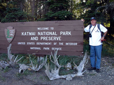 |
Welcome to Katmai National Park |
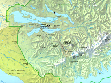 |
Overview of Katmai National Park |
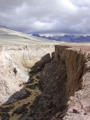
| After looking at the bears near Brooks Camp, hiking up the Mighty Dumpling, taking a shuttle bus 20 miles to the end of the road, and walking downhill for a mile, we came to the unlikely crux of our approach to Mount Griggs, which was a water jump. The three-foot jump spans the Ukak River, which holds the combined waters of Knife Creek, Lethe Creek, and Windy Creek. These creeks drain seven glaciers, and even in August, the amount of water roaring under the jump was frightening. If you miss the jump, you die. | |
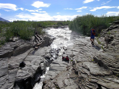 |
The crux of our approach to Mount Griggs You can see the three-foot jump spot between the two packs on opposite sides of the gorge |
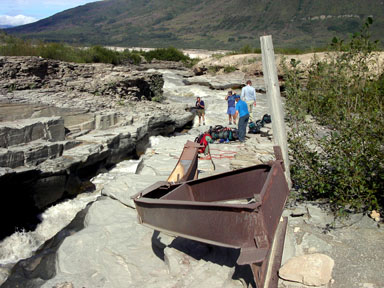 |
Safely across the jump, we examined the remains of a once-sturdy bridge that was easily mangled by flood waters |
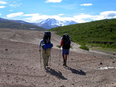 |
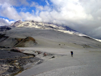
Leaving the water and green thickets behind, Brad Alber and Jobe Wymore launched our hike into the Valley of Ten Thousand Smokes while 7,150-foot Mount Mageik monitored our progress |
 |
Leaving the one mangled bridge behind, we had to wade any other creeks that we come across Here, Jobe Wymore wades the creek draining the side valley west of Mount Griggs We carefully probed ahead with our ski poles looking for hidden gorges in the creeks |
 |
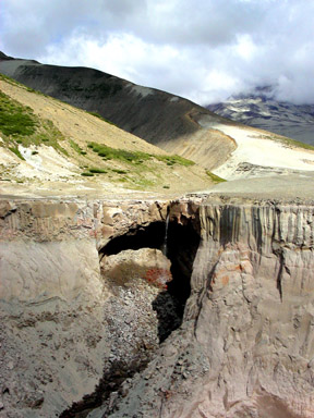
Our simple side creek soon disappeared into a deep gorge, and we felt smart to have crossed it earlier |
 |
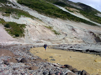
With the side creek hopelessly muddy, we looked longingly at the clear water on the other side of the gorge, as the lower slopes of Mount Griggs started to show themselves beyond the side creek |
 |
We finally turned the corner, and headed into the side valley with our hoped for camp near clear water while Griggs’ lower slopes watched our approach |
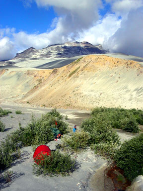 |
Our plan worked, and we pitched camp at the foot of Griggs next to a clear-water spring Walking barefoot in the sand, and enjoying the evening sun, we prepared for the morrow’s climb |
| Gerry took the above photos in August, 2004 | |
| Continue to the Bears | |
| Continue to the Mighty Dumpling | |
| Continue to the Mountain | |
| Continue to the Climb | |
| Continue to the Valley | |
| Continue to the Flight | |
Copyright © 2001-2023 by Gerry Roach. All Rights Reserved. |