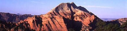
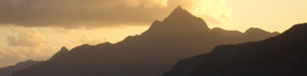
The Gore Range - there are no easy peaks!
– Gerry Roach |
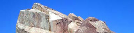
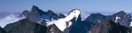
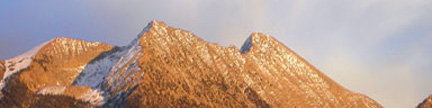
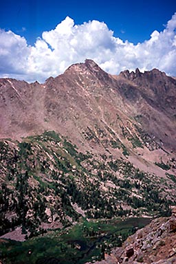
Peak “R” 12,995 feet
Peak “S” 12,857 feet
– Report by Jennifer Roach – Trip July 21, 2002 |
| Colorado’s Gore Range is a special and secretive collection
of rugged little peaks that seem barely touched by the mountaineers of Denver
and the Front Range. With so few visitations, these obscure peaks have few written
descriptions to lure climbers into their lush valleys and steep slopes. We have
found mid-summer to be a prefect time to venture into this wonderful place,
and rediscover its wild beauty. |
 |
Peak “R” (Left) and Peak “S” |
| One of the Gore Range’s Alphabet Nomenclature Peaks, Peak “R” is now considered
to be a Thirteener in waiting. The USGS has added 5-8 feet to all of Colorado’s
high peaks, thus creating 5 more ranked Thirteeners in Colorado. Gerry, Jack
Dais, and I were all anxious to climb this particular peak for all the wonderful
qualities of the Gore Range described above. On July 20, 2002, Gerry and I drove
over from Boulder, and parked at the Pitkin Lake Trailhead, which is located
just east of the East Vail exit on the north side of the frontage road. Upon
exiting Interstate 70, turn sharply right, drive less than half a mile and park in the
designated spaces for the trailhead, which is adjacent to a townhome complex to the east. |
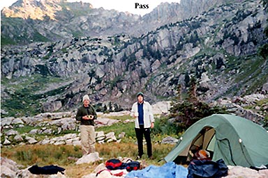 |
Jack and Gerry at our Pitkin Lake camp |
| The backpack up this popular trail begins as a steep hike up a dusty trail, which switchbacks
continuously through aspen groves. Since Pitkin Lake is a popular destination,
the trail is well marked and straightforward. Clouds were already gathering,
and fat drops began to pelt us halfway into our 4 ½ mile journey to the
lake. It was raining hard by the time we reached our destination where we met
Jack who was also just arriving. He had hiked in much earlier in the morning,
then continued up and over two trailless passes and through two valleys in order
to climb another obscure Gore Range mountain, Peak “K.” We swiftly
set up our tent then Jack climbed in with us to warm up and cook our meals together.
Jack had not brought a tent with him, so he swaddled inside his sleeping bag
and bivvy sac when bedtime came, ignoring the raindrops. We did not envy him. |
 |
Morning was clear and soft, the fog burning off quickly |
| In the morning, we consumed a hasty breakfast of hot cereal and coffee, then we were off. The
plan dejour was to climb both Peaks “R” and “S.” Several
days earlier, I had hiked up beyond the 11,400-foot Pitkin Lake and scouted
the passes just east of West Partner Peak to see if there was a passage through
the rugged cliffs. The point of this recon was to enable us to climb Peaks “R”
and “S” without having to do the 11-mile backpack up the Slate Creek
drainage. Sure enough, I found one and confirmed that it went safely through
the slabs and lingering icefields. Jack had used this route the day before and
found it a non-eventful descent, although he confused it with the rugged neighboring
pass to the east on his return trip, which he described as, “scarey third
and fourth class scrambling.” With an hour and a half of easy boulder-hopping,
we reached the 12,460-foot pass, then descended north down its grungy narrows one by one. |
 |
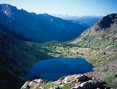
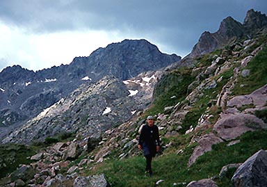
Jennifer in the upper South Slate Creek Drainage |
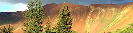
| Below the pass we reached a rocky bench, which was followed by a much longer boulderfield descent
on sometimes unpredictable tippy rocks (I had one roll gash my leg, very nearly
trapping it). The long descent is about 1,000 feet into the lush drainage of
upper South Slate Creek. We did not see any trails leading up this valley, and
it appears quite isolated. The creek is clean and tumbling, and the sun-warmed
rocks invited us to take a quick snack break. From our rest spot, we were able
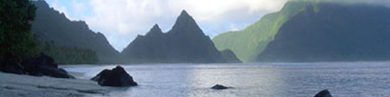
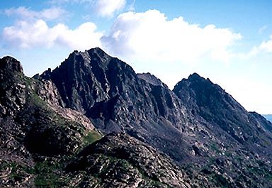
to view our goals, and the equally impressive Peak “Q” seated to
the west. Jack, Gerry and I had climbed this wonderful mountain together four summers earlier. |
 |
The impressive Peak “Q” |
| Striding off again, we angled northeast up through the final twisted pines and massive granite slabs
to a high and pristine area just below the saddle between “R” and
“S.” Moisture laden clouds were floating in and out, but nothing
was forming to saturate our progress. This was the exciting part, and a little
bit spooky. Peering northwest, we three began to “read” the cliff
faces below “R’s” summit in order to locate a passage through
the bands. Yes, there it was. We all three spied something that looked like
a possibility, and with just a few easy class 3 moves, we inched up above the
precipitous sections of Peak “R.” The last few hundred feet are
an easy talus walk, and we marked our descent path back to the cliff section with cairns
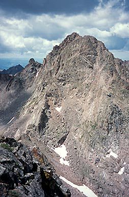
(which we removed on the descent). The last 75 feet of the ascent revealed a stunning view of Peak
“L,” which we three had done on the “Q” trip.
What a thrill to stand on this remote summit! There was no register and only a tiny cairn. |
 |
Jack on the idylic benches below Peak “R” |
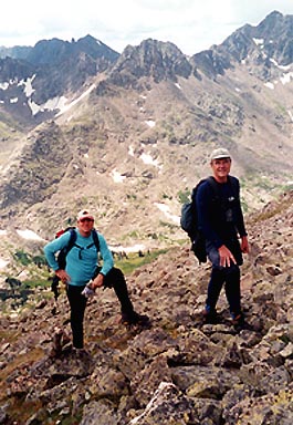 |
Gerry and Jack near the summit of Peak “R” |
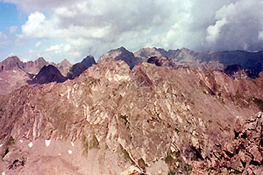 |
Looking northwest from Peak “R” |
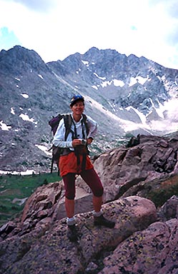
| The traverse over to Peak “S” is much easier and more straightforward. We traversed
northeast above some cliffs, and climbed up a steep gully directly into the
12,460-foot saddle between “R” and “S.” It was here
that we made the fortunate discovery that, had we attempted to ascend “R”
from this saddle, major cliffs would have stopped us. Our trip to the summit
of “S” was short and pleasurable. The rocks are generally solid,
and invite a carefree scramble. The summit of this peak is a very small,
airy perch, with a wonderful view down to Upper Slate Lake and its monarch,
Peak “L” rising above it. We reveled together that we had already “been-there-done-that.” |
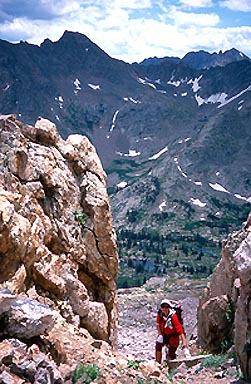 |
Jennifer approaching the R-S saddle |
 |
Mighty Peak “L” |
| The descent back to the South Slate Creek valley floor was uneventful. We took a brief drink
stop by the gushing creek, so sweet with cold summer runoff. Mosquitoes drove
us to our feet as we steeled ourselves for the 1,000-foot slog back up through
the boulders to our unnamed pass. Eyes find the route, but dogged determination
decides the pace. Eventually, Gerry and I made it to the bottom of the pass,
while Jack followed. I went first up the rubble chute, taking extreme care not
to dislodge any of the crumbling rocks. Resting, gasping on the pass, I watched
Gerry ascend, followed by a smiling Jack. After a well-deserved break spent
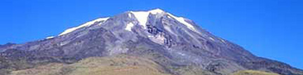
gazing in appreciation at distant Outpost Peak, we descended the steep dirt,
grass, and boulders. Bench by bench, Pitkin Lake and our green tent became gradually
closer. We were back at camp by mid-afternoon, and elected to have some soup
before packing down the trail. Once on the trail, we hiked quickly down the last few trail miles.
The cars were a welcome relief, almost as good as pulling off those overheated boots. |