You’re in my frame!
– A petulant photographer parked in the middle of the road |
Mount Owen A – 13,340 feet
Cruising west of the crest, this thirteener provides a sanguine ascent to a view-fest summit in the Sangre de Cristo.
Located in the center of the Sangres, you can see from the Culebra Range to the south, to beyond Bushnell in the north. |
 |
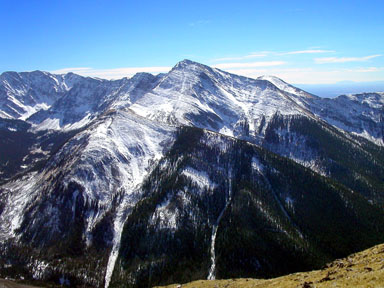
Mount Owen seen from the north across Cotton Creek
The top of the West Slopes Route is the right skyline
Gerry took this photo from Mount Niehardt on 10/16/04
|
USGS 7.5’ Quadrangles: Electric Peak, Rito Alto Peak, Mirage
West Slopes – 9.2 miles RT, 4,820 feet net & feet total, Class 1+ |
| This is an easy hike to a high peak in the Sangres.
Start at the Wild Cherry Trailhead and follow the Wild Cherry Trail
east into the narrow canyon. Unlike the Major Creek Trail with its bogs, the excellent, no-nonsense Wild Cherry Trail
gains elevation steadily as it switchbacks up along the creek’s north side. After 3.4 miles, reach a large meadow at 11,200 feet,
where you can see the rounded mass of Mount Owen to the northeast. Continue 0.3 mile east on the trail across the meadow,
and hike to the sixth switchback (one switchback equals one turn) above and east of the meadow. Your Class 1 approach is over.
Leave the trail here and climb 0.2 mile directly north up the steep slope above, perhaps utilizing a grass alley between the pines (Class 1+)
to reach Mount Owen’s open west slopes at 12,000 feet. From here hike 0.7 mile northeast then east up easy grass and tundra slopes (Class 1+)
to reach the summit and its dramatic views. |

